Field
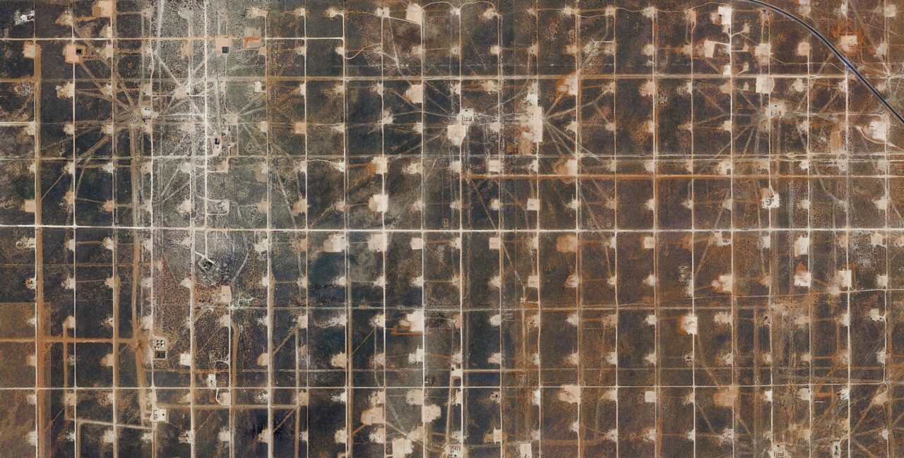
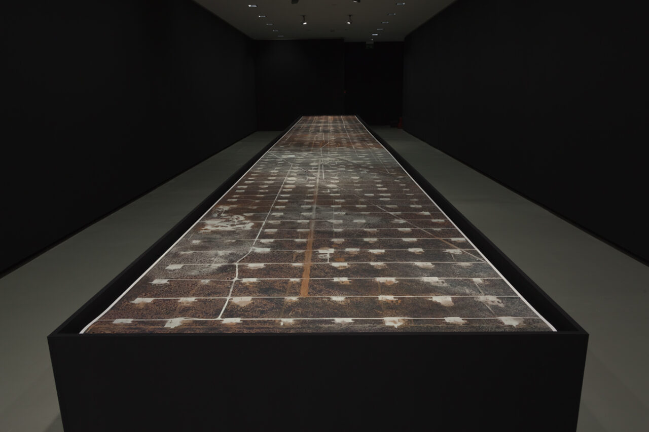
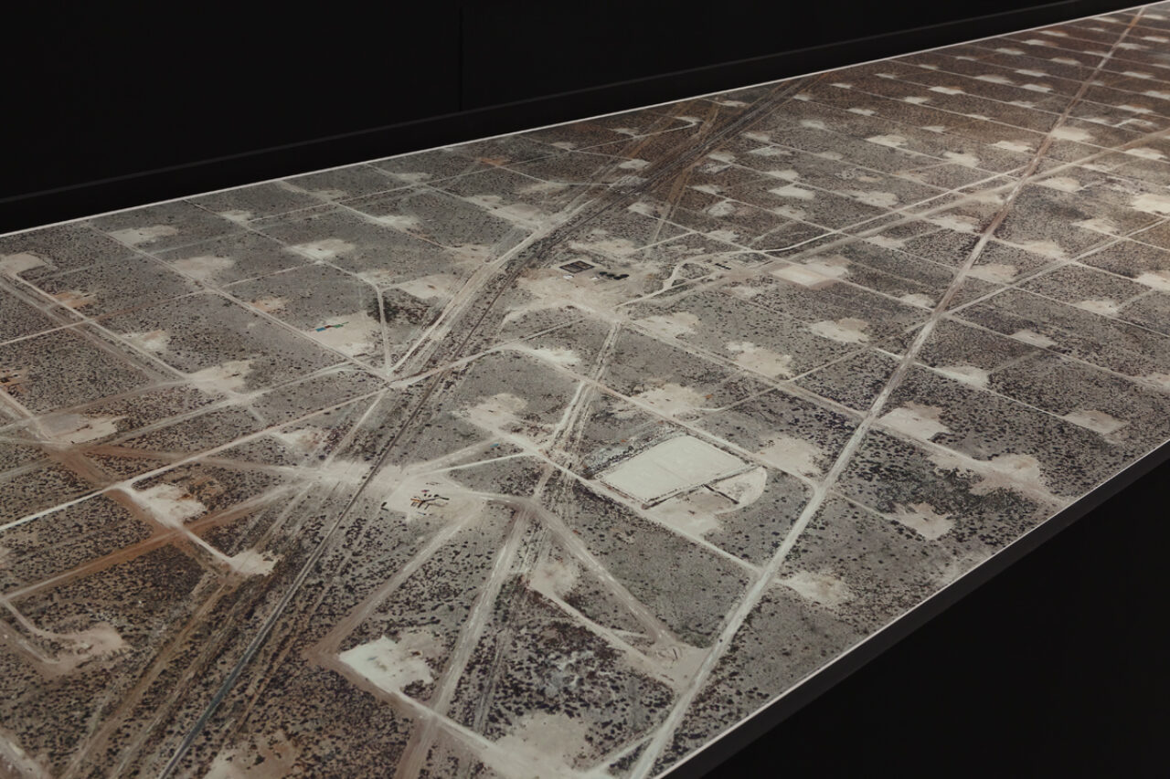
Nowadays, we see the world through the filter of Google Street View, Google Maps or Google Earth: these programmes, launched by the web giant around 10 years ago, enable us to fly over our planet. Field by Mishka Henner consists of an assemblage of very high definition satellite photographs, which are freely available on the Internet. The image stretches over 13 metres in length and appears at first glance to be an abstract, geometric painting; yet on looking more closely, you realise that these are oilfields. They are located at the centre of the United States, a region that has fed Americans’ ever-growing energy needs for around a century. The territory extends over 96 km2 and consists of 935 producing wells and 440 injecting wells, although they are no longer all active. To extract the oil, 9200 million litres of carbon dioxide are injected into the ground each day. Henner thus offers an alarming perspective on this oil drilling, which, in his view, represents both a cultural and an industrial landscape. The satellite image, captivating in many respects, also serves as visual evidence of the destruction inflicted on our planet.